
Firefighting has thankfully been reasonably clear of midair collisions, but the question is, will this continue? Is it time to use technology to help prevent midair collisions in the often tight and congested airspace over a fire? We examine the potential use of ADS-B to assist the firefighter stay safe.
As forest- and bush-fires have become more intense and threatened more lives and property, aviation has become a fundamental firefighting tool. Despite more and varied aircraft in tight airspace, the instances of midair collisions have been few. This does not mean there haven’t been any and yes, they do occur. Indeed, as a risk event, collisions in the firefighting environment relying solely on ‘see and avoid’ are almost certain to occur.
Mid-Airs
In December 2009, two firefighting helicopters collided during firefighting operations in New South Wales in Australia. Although both aircraft were damaged, amazingly no-one was injured. The Australian Transport Safety Bureau (ATSB) noted in the report that;
“There were no published procedures for pilots to follow to ensure separation from other aircraft when there was no air attack supervisor present. Instead, the system relied on the airmanship and experience of pilots to mutually arrange separation. In this case, the water source was about 600m from the fire front and NFO had departed the water source shortly before LXC. The investigation established that neither pilot was aware of the position of the other helicopter as they approached the drop point.”
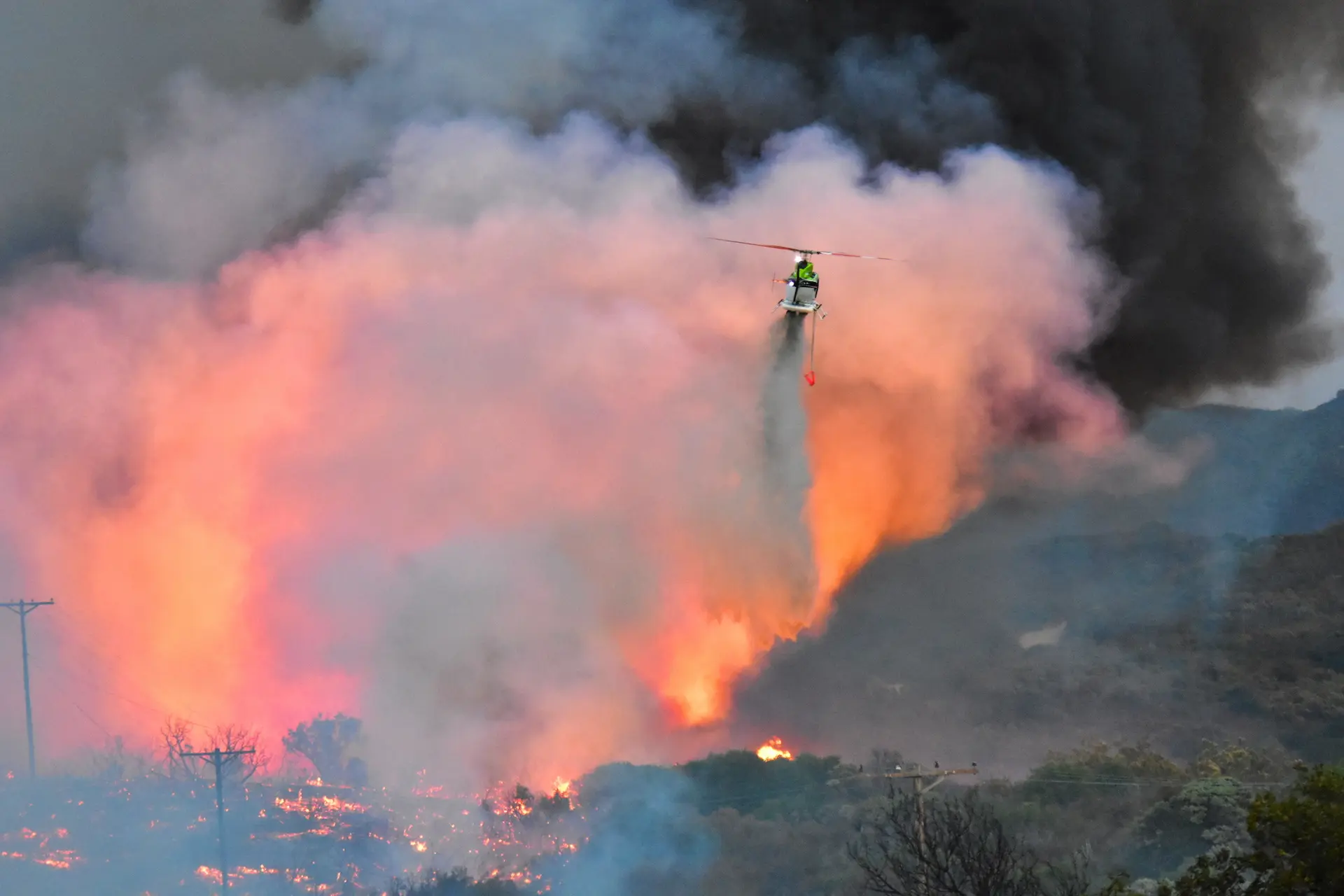
In July 2020, two SEAT aircraft collided over the Bishop Fire in southeast Nevada, USA. Both pilots were fatally injured. The investigators found that the tankers were working in tandem with one close behind the other. After the following aircraft’s windshield was coated in retardant from the preceding aircraft’s drop, it made a rapid climb then suddenly turned left, colliding with the other tanker.
In both examples, pilots lost situational awareness. In each accident the pilots were aware the other aircraft were in the area and yet they still collided.
In 2004, the ATSB issued a report on mid-air collisions[1]. The report found that most (78%) mid-air collisions in the period (1961 to 2003) reviewed occurred in or near a circuit area. A high proportion of the collisions (35%) occurred on final approach or the base-to-final turn. Most of the collisions involved one aircraft colliding with another from behind, or both aircraft converging from a similar direction. Generally, the mid-air collision characteristics in Australia appear to be like those in other countries such as the US.
Reviewing the US and Australian data, it would be more accurate to describe most collisions as occurring at ‘focal points’; areas where aircraft are converging. Focal points may be approaches to airfields, runways, or even tourist destinations etc. areas where pilots are often focused on setting the aircraft up to approach, land, or flyover.
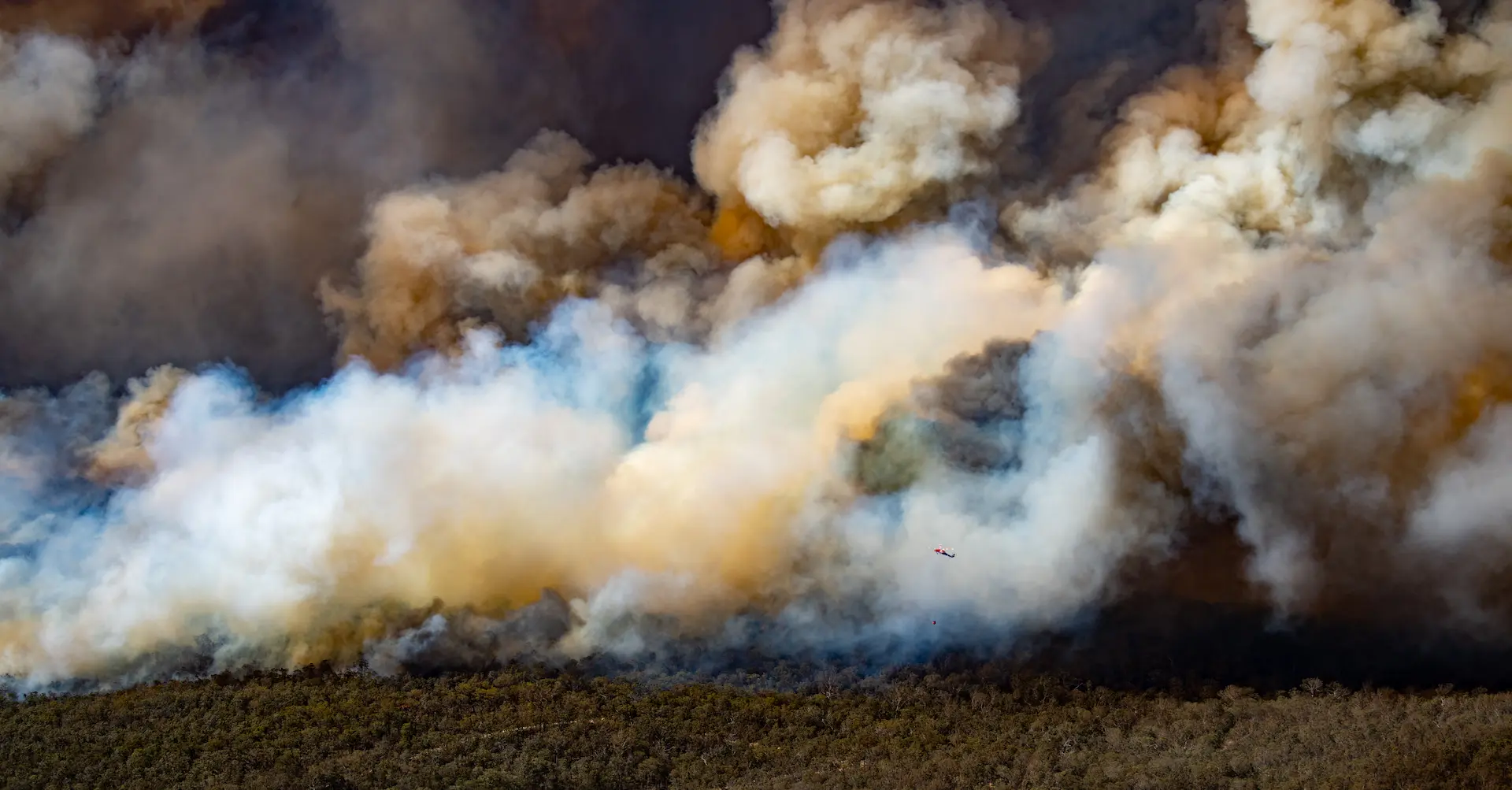
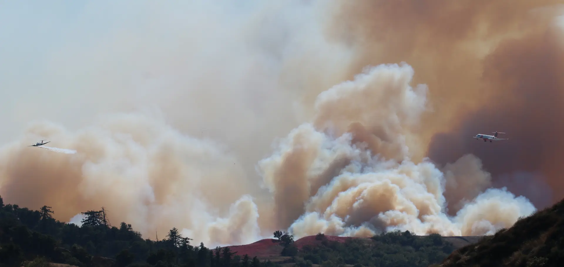
Similar circumstances exist at firefighting incident locations, where essentially aircraft are flying circuits and setting up on ‘finals’ to a point. There could be several aircraft converging to a focal point (the area or he drop zone). Complicating the environment could be poor visibility, radio chatter not related to separating aircraft, and conditions such as heat and turbulence.
Consequently, ‘see and avoid’ as a sole method for separating aircraft, especially at focal points, is demonstrably ineffective and highly risky. Yet, this is the method highly relied on during aerial firefighting operations.
In NSW RFS operations, even those times where an Air Attack Supervisor is controlling the attack and traffic information is passed, ‘see and avoid’ is still the predominant method of separation. The limitations of ‘see and avoid’ are exacerbated by:
- Reduced visibility in smoke and haze
- Concentration of aircraft within a confined area
- Focus of pilots on the fire attack and avoiding terrain
- Potentially distracting significant radio chatter
NSW RFS airspace management procedures presently do not account for the limitations of the ‘see and avoid’ principle in maintaining aircraft separation.
More aircraft, more varied
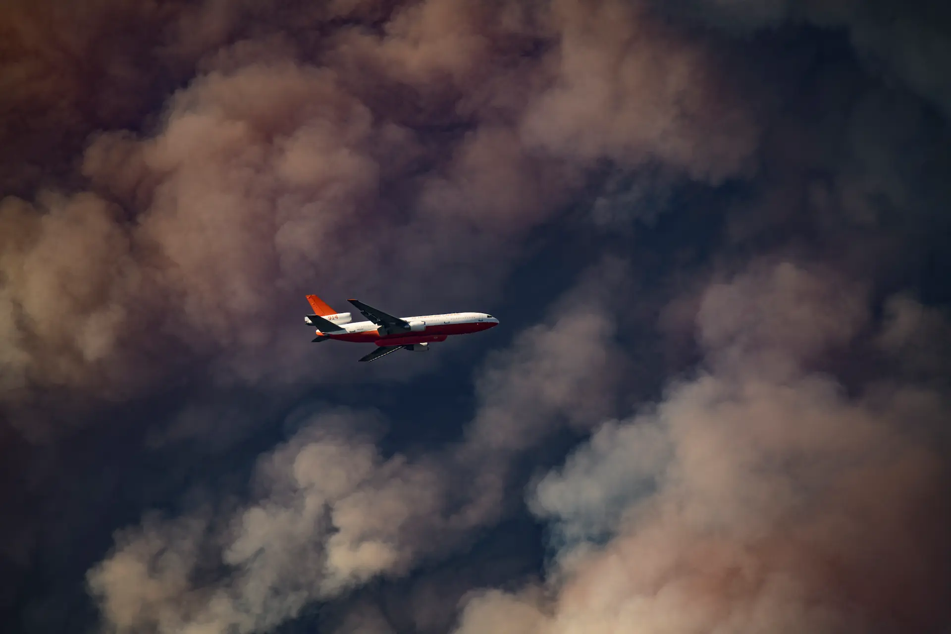
Over the last decade or so, the intensity and geographical expanse of fires have increased and as a result, required the use of multiple aviation assets, either individually or in combination. The utilisation includes small and large helicopters, SEAT (Single Engine Air Tanker) and LAT/VLAT (Large and Very Large Air Tanker). Additionally, improving capabilities such as the use of NVDs (Night Vision Devices), reconnaissance aircraft and retardant utilisation results in more and disparate aviation assets working in confined airspace in significantly variable conditions.
Consequently, airspace management and separating traffic have become significant considerations due to:
- increased amount of traffic within the firefighting airspace (larger and more intense fires needing more and greater capability assets)
- a greater variety of aviation assets (i.e., single, and multi-engine helicopters performing a variety of roles, SEAT and LAT/VLAT aircraft)
- aviation assets that have signification variation in performance (i.e., different helicopter, SEAT and LAT/VLAT performance profiles)
- different operating requirements for certain aviation assets (e.g., Bird dog aircraft for the LAT/VLAT); and
- larger and more intense fires needing increased airspace,
-copy.webp)
Regulated separation standards for aircraft operating in visual conditions under visual flight rules are generally 500ft (152m) vertically and horizontally although ‘see and avoid’ principles apply.
‘See and avoid’ has proved to be a significantly weak method of separation as identified in research pertaining to midair collisions between aircraft. In 1991 the ATSB's predecessor (BASI) published a research report titled ‘Limitations of the See-and-Avoid Principle’. This report concluded that 'the see-and-avoid principle in the absence of traffic alerts was subject to serious limitations. The BASI report noted that unalerted see and avoid has a 'limited place as a last resort means of traffic separation at low closing speeds…'.
The United States National Transportation Safety Board (NTSB) in 2016, released a series of animations created from the pilot’s view in the cockpit from three of the four aircraft involved in two mid-air collisions. The animations revealed not only the difficulty the pilots would have experienced seeing the other aircraft for a variety of factors, but also the value of cockpit traffic technology as a supplement to the human eye.[2]
Many of the limitations of ‘see-and-avoid’ are associated with the physical limits of the human eye, cockpit design, and human perception.
As well as the mid-airs noted before, there have been numerous accidents at focal points such as approaches to airports and tour points of interest as well as during news coverage. Focal points tend to have aircraft converging on approach while the pilots are primarily focused on where they are going. This is no different from firefighting except firefighting usually involves degraded visibility, high workload and multiple distractions.
Current Risks
The reality is that airspace coordination and traffic deconfliction is a shared responsibility among pilots, Air Traffic Controllers, and Air Attack Supervisors depending on the type of airspace and incident management.
The primary focus in airspace coordination, with respect to aerial firefighting, is mid-air collision avoidance followed by the effective delivery of retardant or conduct of surveillance activities. When performing most aviation firefighting tasks, the pilot’s attention is diverted out of the aircraft toward the ground, conflicting with their primary responsibility to ‘see and avoid’ other aircraft or obstructions. Other users of this airspace may have similar workload distractions and therefore, it needs to be recognized that the people involved on the incident scene are likely to be:
- experiencing significant workload;
- fatigued;
- task focused; and
- have their attention easily diverted.
Ultimately, relying on ‘see and avoid’ is highly risky and provides minimal separation assurance in high workload situations.
Technologies
Limitations in managing high intensity operations in firefighting operations low visibility airspace include the reality of training for both the air attack supervisor and the firefighting pilot being limited in availability and scope (due to financial and resource constraints) and the physical limits of human capability to acquire, process and action information to develop and maintain situational awareness.
The leveraging off existing and near-to-implementation technologies may provide a significant opportunity to greatly increase the safety of operations over firegrounds by improving the participants’ situational awareness.
The concept of any ‘system’ of management, especially considering the disparate types of aircraft involved in fighting a fire is the need to keep the procedures and process simple. Pilots need to be able to be provided information in such a way that gives them the situational awareness while not increasing their workload or diverting their attention. That method presently used is radio yet the reliance on just radio communications is risky because:
- )The pilot must ‘interpret’ the information being provided (translate from wordage to a mental model) which can be misinterpreted and takes the pilot’s concentration to interpret the information,
- )Radio calls can be ‘stepped on’ (over transmitted by other calls leading to interference and non-intelligible garble),
- )Radio calls rely in the clarity of the person transmitting and the quality of the signal being sent and received,
- )The radio call must describe the three-dimensional space (location, boundary and height),
- )Radio calls take a significant amount of time for the information to be imparted and understood;
- )The information provided in a radio call must be mentally recalled and is therefore subject to unintentional error, misunderstanding, or being forgotten, and
- )The radio call also must provide a lot of information such as the position of other aircraft to reduce the chances of traffic conflict.
The military has taken significant strides in using technology to provide the pilot with information that is readily interpreted. Data linking, Head Up Displays, touchscreen controls and blending information from various sensors have been achieved and are in regular use. The problem is that much of this technology takes time to filter at a reasonable cost into the civilian space.
Several separate technologies, however, presently exist that could be used individually or integrated to improve the effectiveness of each and should not require relatively high-cost implementation.
Ultimately, the aim of any system would be to provide the information in a graphical or ‘picture’ form thereby reducing the need for radio and improving the situational awareness of pilot. As the old adage goes, ‘a picture is worth a thousand words.’
Essentially, the pilot needs to know:
- Where am I (e.g., what is my location, what is the location of the task, what airspace is around me? Etc.)
- Where am I in relation to the task (e.g., where’s the fire, what’s the direction of attack, where are the obstacles, where is ground, what is the wind, where’s the sun? etc.)
- Where am I in relation to other aircraft (e.g., where are the other aircraft, what direction are they going, what height are they, how close are they? etc.)
Pilots presently depend on maps, GPS, observation, and advice from other pilots and/or the AAS to gather and assimilate the information – all the while dealing with turbulence, heat and limited visibility!
Where am I?
Present satellite-based technology (e.g., GPS) and data is readily available providing aircraft location and systems are readily available to represent the aircraft position graphically.
Where am I in relation to the world?
Again, satellite technology provides positional information and the technology to take the information and present it on a moving map widely exists (e.g., Garmin developed systems).
Where am I in relation to other aircraft?
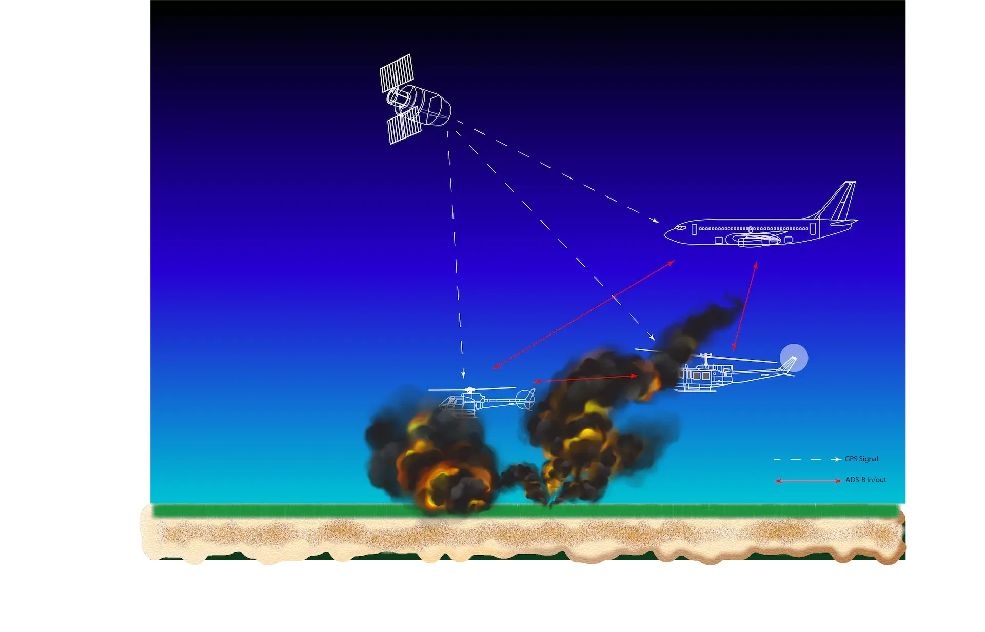
Countries around the world are implementing a more accurate way of tracking aircraft. Called Automatic Dependent Surveillance–Broadcast (ADS-B), the technology will eventually replace radar as the primary surveillance method for Air Traffic Control (ATC) monitoring and separation of aircraft worldwide.
ADS-B
ADS-B provides real-time shared precision information to each pilot and air traffic controllers. The system relies on an aircraft’s GPS receiver to determine highly accurate position and groundspeed information, which it calculates by receiving signals from a network of satellites.
Systems then take this GPS data and, along with identification and flight-status information, transmit it to ground-station receivers using a datalink transmitter in the form of a Mode S transponder. Updates automatically occur a minimum of once every second, compared with existing radar-based systems, which typically scan for data once every five to 12 seconds. ADS-B, compared to standard radar, therefore provides a much more accurate picture of the traffic landscape at any given time to a controller or other aircraft.
ADS-B allows equipped aircraft and ground vehicles to broadcast their identification, position, altitude and velocity to other aircraft and ATC. This is called ADS-B Out. Being able to receive this information is known as ADS-B In. In the USA, all aircraft were to be equipped with at least ADS-B out by the beginning of 2020. ADS-B works on frequency 1090Mhz which is the same frequency used by aircraft transponders.
Regulations have been published by different countries mandating ADS-B on aircraft operating in their regions according to differing schedules. Some countries that don’t yet require the equipment have designated special routes and airspace to benefit those who voluntarily equip. In the USA for example, generally, if an aircraft wishes to operate in most controlled airspace, it requires ADS-B Out. Europe requires that all aircraft operating IFR must be compliant with Mode S Elementary Surveillance, while Commercial Air Transport types must be compliant with both Mode S Enhanced Surveillance and ADS-B Out requirements. In Australia, aircraft operating under instrument flight rules (IFR) were required to be equipped with ADS-B out in 2017. VFR aircraft are also required to have ADS-B out when operating in certain classes of airspace.
ADS-B In (ADS-B reception by aircraft) can be used as a pilot situational awareness tool and enabler of new operations using airborne separation assurance/collision avoidance systems.
The information is also shared among aircraft. Aircraft with ADS-B In capabilities can receive this information either directly from other aircraft or via the ground stations, which re-broadcast it along with position data for non-ADS-B-equipped aircraft that have a transponder and are within radar coverage. Temporary ground stations can also be installed for specific purposes such as firefighting.
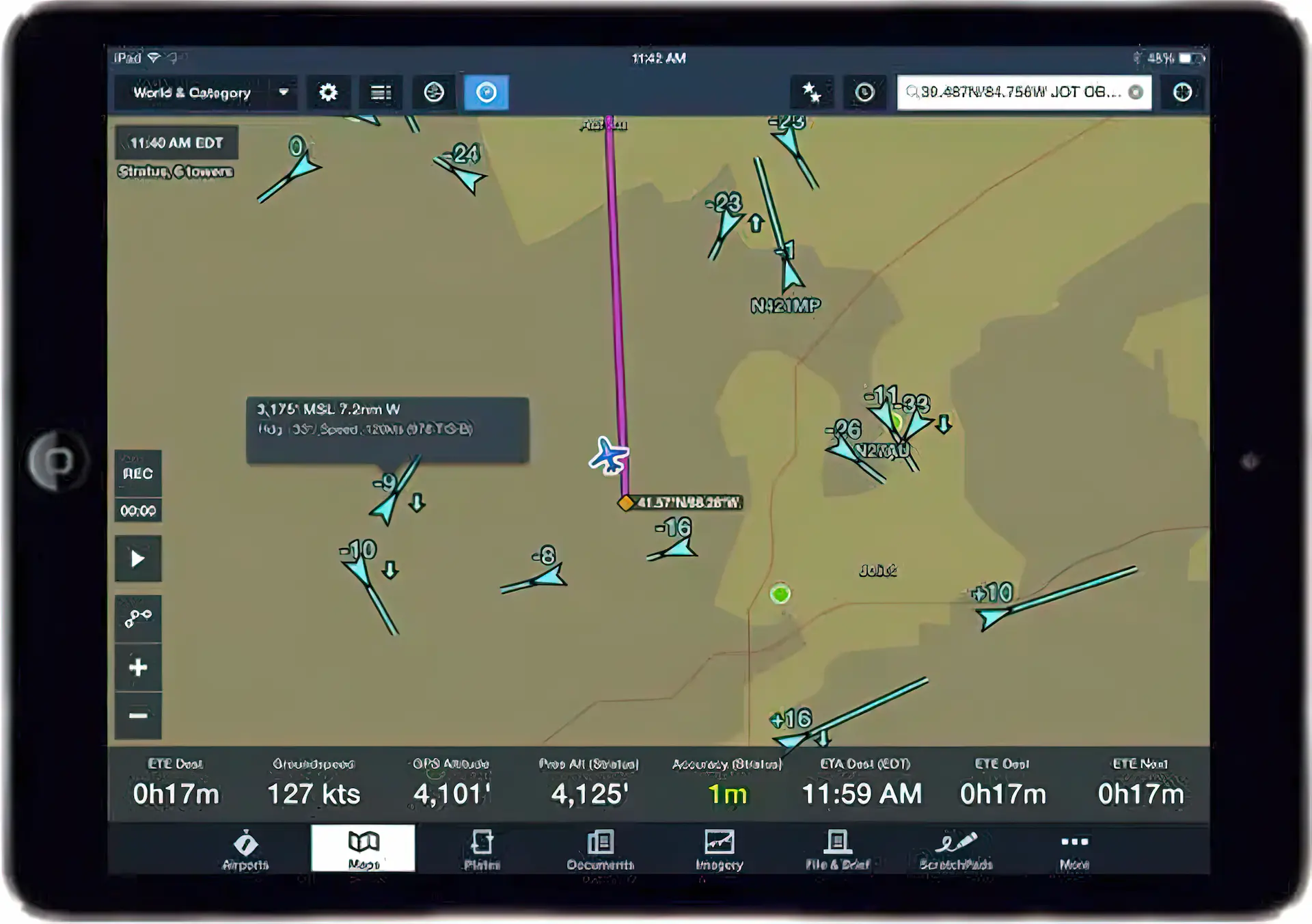
Traffic Display
Traffic is the most basic output product of an ADS-B receiver. Most systems output traffic data in two ways: The old traffic data format (TIS) can be displayed on almost any legacy display such as a Garmin 430. This traffic is usually displayed as diamonds with arrows for altitude trends. Newer ADS-B traffic format offers much more information to the pilot. Traffic can be displayed as directional arrowheads and include vector lines depicting an aircraft’s track and speed. Traffic also is color-coded to indicate proximity and converging paths of flight. The pilot can view information about the target aircraft such as altitude, aircraft ID, and aircraft make/model.
For full ADS-B traffic display functionality, displays need to be selected that work natively with the ADS-B receiver. Sometimes this requires that both the display and the receiver be the same brand. That situation has been improving recently with many of the avionics companies sharing their data formats.
ADS-B ground stations are line-of-sight facilities. The ability for a ground station to receive ADS-B data from an aircraft depends on altitude, distance from the site and obstructing terrain. Coverage exists near the surface within 20 nautical miles of the ground station. High level coverage can exceed 250 nautical miles
Potential to share information
Previously, data needed to be transmitted via a radio link or via the cell (mobile) telephone system. The internet is now generally available anywhere through systems such as Starlink which, using advanced satellites in a low orbit, enables video calls, streaming, and other high data rate activities that have not been available via satellite internet.
According to Starlink, download speeds between 100 Mb/s and 200 Mb/s and latency as low as 20ms can be achieved. Starlink is in active discussion with the airlines to bring an airborne service and has already reached agreement with Hawaiian Airlines. Whether a system such as Starlink could be used to widely distribute information among aviation assets or used as a node by an air attack supervisor is unknown. It does offer the tantalising potential for data and imagery to be sent to any point via high speed internet.
The concept would be to integrate fully or partially some or all of these (or similar) technologies to:
- )Provide real time graphical information to the AAS of aircraft position and fire activity;
- )Rapidly upload and download mission or task information including the potential to provide fly to points to tankers and helicopters;
- )Graphically provide traffic and position information to pilots in the firefighting airspace to reduce radio and improve (and simplify) situational awareness; and, potentially;
- )Provide real time information to the firefighter on the ground either through an ADS-B link or a high-speed internet-based system such as Starlink.
The Challenge
There will be some who think that the pilots’ eyes should be out of the cockpit and not inside. My question then is that when eyes out of the cockpit has been proven to be such a poor defense to mid-air collisions, how can a technology that improves a pilot’s situational awareness be ignored or even shunned? Equally, do these same people believe pilots should not be monitoring their aircraft’s mechanical performance by referencing the gauges?
Technology is readily available to significantly improve the situational awareness of all players involved with fighting a forest or bush fire, whether it be in the cockpit, on the fireground or in HQ. Some aspects of modern technology have fundamentally failed in keeping the pilot ‘in the loop’ but a display that lessens the workload by presenting a picture to the pilot of where aircraft are will surely lessen the risk of operations in confined airspace. The military has already demonstrated how valuable Link systems are in helping to keep everyone on the same operational page.
It is time aerial firefighting moved on from the 1960’s.
[1] Review of Midair Collisions Involving General Aviation Aircraft in Australia between 1961 and 2003
[2] https://www.youtube.com/playlist?list=PL5aVmmm4Qt9H9XDVaSTJawGLHP7ZVpdp6