
Over the years as its capabilities began to mature it quickly became obvious that the unmanned aircraft had potential in many fields. In the counter-wildfire role it could have been developed for reconnaissance, and with a little more thought, for direct support. Yet even while farsighted organizations in wildfire-fighting have been trying to acquire and use unmanned aircraft, there have been incidents of such aircraft not helping but actually hindering operations. A.R. Prince reports.
Several times over the past months the presence of smaller unmanned aircraft, personal drones, operated by members of the public, has led to the suspension of aerial firefighting operations. The drastic response has been because of the vulnerability of manned aircraft to strikes by even light unmanned types. In an incident, in August this year involving an Idaho fire, a personal drone nearly collided with a helicopter. Apparently, the helicopter pilot had to maneuver his aircraft to avoid the collision. Personal drones have also hindered firefighting by the drones crashing and actually starting fires. Only a small number of offending personal drone operators have confessed or have been found by authorities.
RECONNAISSANCE
Over the last few years various unmanned aircraft have been used for wildfire reconnaissance and surveillance, in the USA and elsewhere. The most recent developments are discussed in the following.
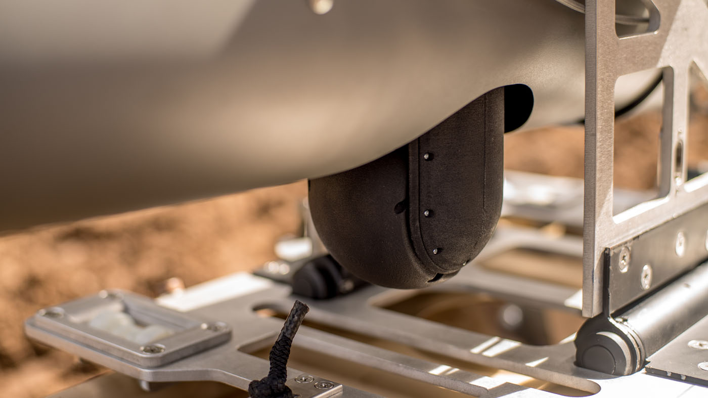
These unmanned aircraft, and the other professionally-operated unmanned aircraft discussed in this article, are also known as unmanned aerial vehicles (UAVs). Among the most capable and indeed at the other end of the unmanned aircraft spectrum from the personal drone, is the General Atomics MQ-9 Reaper of the US Air National Guard (ANG). The MQ-9 is 36ft (11m) long with a wingspan of 66ft (20m), and a maximum take-off weight 10,500lb (4,800kg). Using a turboprop engine that is used in commuter and utility aircraft, it has a highly effective range of 1,150 miles (1,850km). A comprehensive sensor suite comprising an infrared sensor, color/monochrome daylight TV camera, image-intensified TV camera, laser range finder /designator, and laser illuminator completes the drone’s capabilities.
In 2013, the MQ-9's predecessor, the now retired MQ-1 Predator, gave firefighters for the first time the ability to see live the video feed recorded by an aircraft flying over a fire. The live transmission also included thermal imagery. Data capacities have increased with the MQ-9. Data received at the wing of the ANG operating the MQ-9 is not only from the aircraft but also from other civil and military organizations. The quantity of data indeed is such that firefighters can choose what they want to be sent (by the ANG wing). The MQ-9's role is known as incident awareness and assessment. The title suggests the importance the aircraft has acquired. During the five years that the MQ-9 and the MQ-1 have been assisting firefighting in California, they have flown against the state's largest fires.
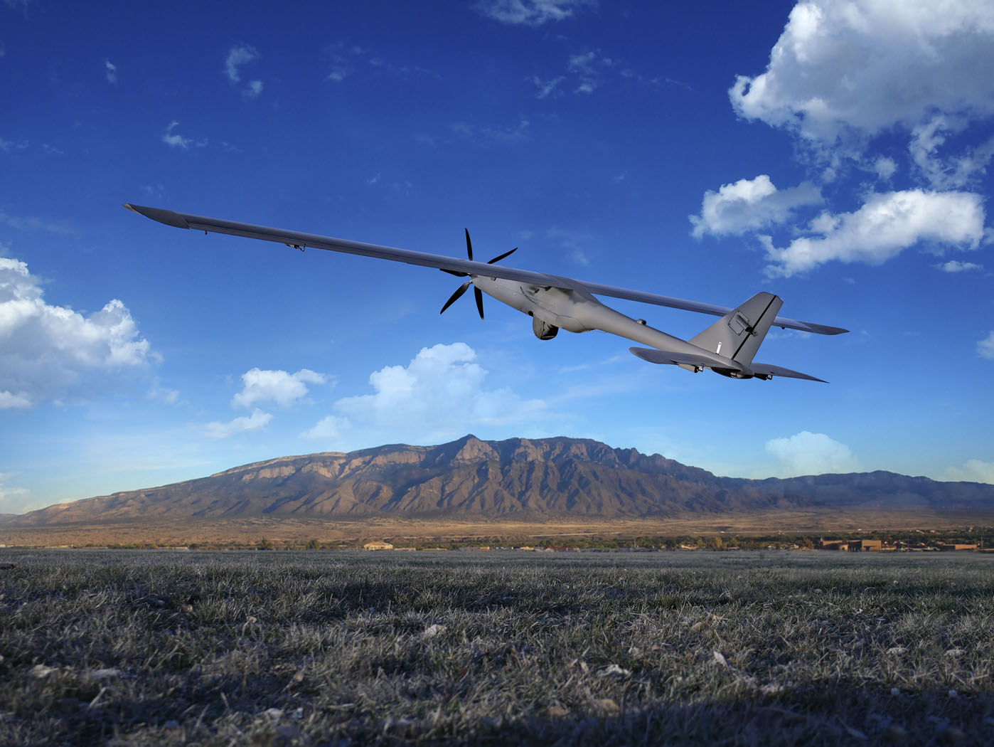
No other UAV used in countering wildfires is comparable to the MQ-9. Of the others, one of the more capable is the Insitu ScanEagle. Just over 5ft (1.6m) long with a wingspan 10.2ft (3.1m) and an empty weight of 35lb (16kg), ScanEagle’s outstanding characteristic endurance, more than 24 hours. Insitu’s drone has infrared sensors and electro-optical cameras. More recently the TK-5 Firewatch mapping payload has been integrated. This will be able to map more than 50,000 acres (20,000 hectares) per hour at resolution higher than high-altitude or space-based multi-band imaging systems. Simultaneous imagery collected includes the visible, near infrared, and thermal infrared spectral bands. In June it was announced that Insitu had received a contract from the US Department of the Interior (DOI) to provide ‘call when needed’ services using the ScanEagle. In August a ScanEagle used to monitor an overnight burn operation in Oregon detected a spot fire, which firefighters on the ground had not been aware of, outside the fire line in an unburned area. The ScanEagle pilot was able to directly inform the firefighters the location of the spot fire.
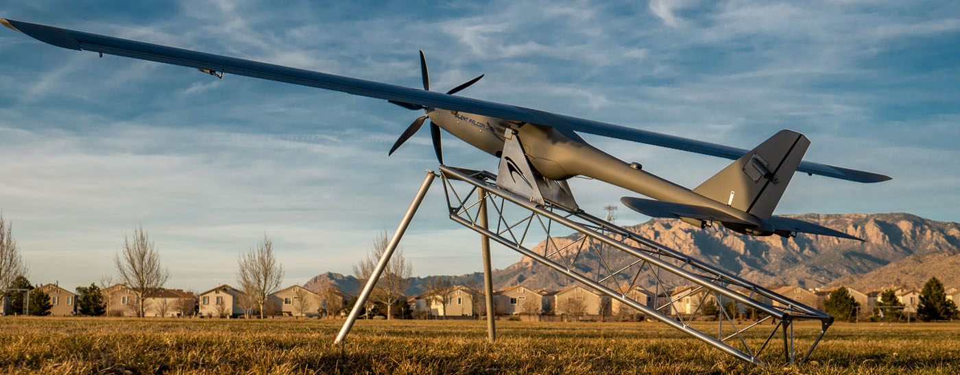
Another capable UAV, of similar size to the ScanEagle, is the Silent Falcon, has an endurance up to 5 hours, depending on conditions. Sensors are electro-optic/infrared. In June it was announced that Bridger Aerospace had received a contract from the DOI to provide ‘call when needed’ services with the Silent Falcon. The following month a Silent Falcon was used to map unburned areas, find remaining areas of heat, and identify damaged structures in a Nevada wildfire.
An advantage the ScanEagle and Silent Falcon have over the MQ-9 is that they can be launched from catapults and recovered by parachute, thus do not require runways. They can operate from within Temporary Flight Restriction (TFR) areas imposed by the (US) Federal Aviation Administration over wildfires. Unmanned aircraft operating outside TFRs require chase-aircraft accompaniment.
ATTACK
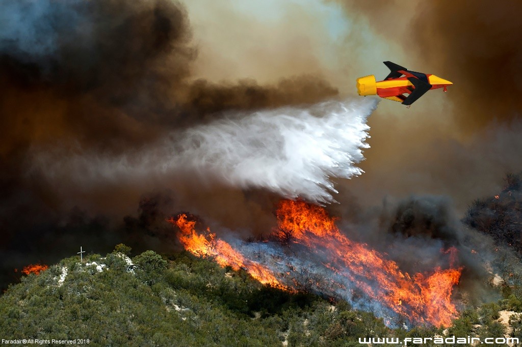
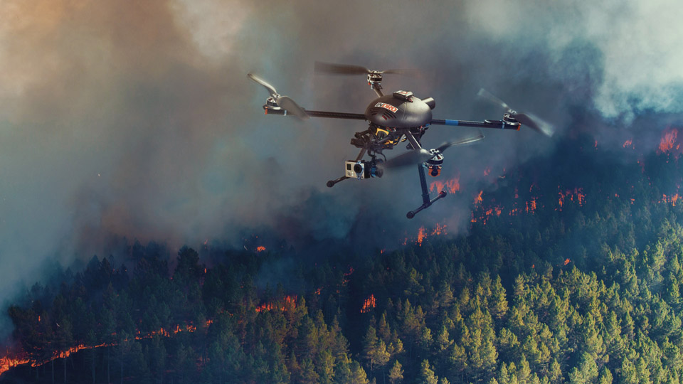
In 2018 UAVs were used more aggressively against wildfires. In August quadcopters were used in Oregon to start strategic fires in difficult terrain, considered unsafe for firefighters. The aircraft dropped small balls which shortly after, self-ignited. The balls contained potassium permanganate powder and were injected by the UAVs with liquid glycol before being dropped. The reaction of the two chemicals cause the ignition. The technology had been developed by the University of Nebraska and of note was the fact that the balls could be very precisely dropped. The eventual intention of such technology is to develop UAVs small enough to fit in a firefighter's backpack, yet advanced enough for environmentally safe operation.
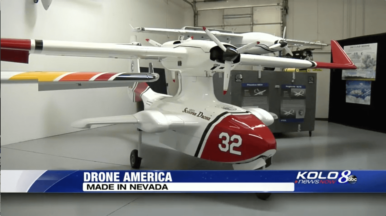
Another area of development is the unmanned air tanker. Drone America has such a variant of its Ariel amphibious UAV. The Ariel is 16ft (4.8m) long with a wingspan of 22ft (6.8 m) and an average payload weight of 350lb (160kg). Average flight distance is about 650 miles (1,000km). Drone America and Thrush Aircraft are developing the Ariel into an air tanker with the capability of dropping 800gal (3,000l) of water or fire retardant. It will also be able to conduct long endurance surveillance over a fire, with the baseline Ariel having an endurance of more than 10 hours, depending on conditions. Drone America has also proposed the Ariel Scooper Drone which is to have a 1,000gal (3,800l), 8,500lb (3,900kg), day-or-night payload capability.
Yet another UAV tanker concept is the Faradair BEHA-M1AT. It is configured with a triple box wing, of span 36ft (11m). Payload would be 22,000lb (10,000kg). The BEHA-M1AT would be able to deliver fire retardant in repeat cycles without human-operator involvement. The wing configuration is said to give the aircraft short take-off and landing capability and it would also be rough-field capable.
The Drone Hopper comprises a circular external hull containing six compartments with a double-hexacopter propulsion system. The hull space not occupied by the compartments would be filled with water: the hull diameter being 3.9ft (120cm) and height 1.0ft (30cm). The maximum water capacity would be 80gal (300l). Over a fire, the high-speed air current that the propulsion system's propellers generate would be used to spray the water. A magnetic dispenser system would control the sprayed water, including its intensity. Navigation systems and heat sensors would locate the appropriate point to extinguish the fire, and also coordinate the operation with other Drone Hopper aircraft. A variant called the Wild Hopper is to have a water or fire-retardant capacity of 160gal (600l).
As for the Drone Hopper, UAVs in counter-wildfire roles are being considered where relevant for group operations. Such operations would enable UAVs, and specifically here UAV tankers, whose payloads are much smaller than their manned counterparts', to make a more substantial contribution to countering wildfires. A European Union-sponsored program led by the Istanbul Technical University, Turkey, is considering the use of UAV tanker groups. A first step is the estimation of fire spread direction from infrared sensor streams obtained from UAVs. Patterns found in the data allow predictions to be made. Then [facilitated by computer programming] UAV actions against the wildfires can be coordinated. The program, begun in 2017, is due to conclude in March 2019. The last phase comprises flight tests against actual wildfires.
PILOT OPTIONAL
The US DOI is promoting the type of UAV that is derived from a manned one, and which retains the option of being pilot-controlled. It is called an optionally piloted (OP) aircraft. The DOI is particularly interested in the OP helicopter, releasing a background paper on the subject in July:
OP aircraft would be able to fly during the 16-hour, overnight period when manned aircraft do not. The DOI notes that the fire would then
be weakest, the night and early morning with higher humidity, lower temperatures and less wind usually better for firefighting [the
advantage of course is also had by non-OP UAVs, compared to manned aircraft]. Further, many fires start in the late afternoon, and they are
most susceptible to suppression just when manned aircraft can't fly, in the night. The DOI states that OP aircraft, first must have
features and system redundancies for pilot safety, which also increase aircraft reliability and sustainability even in degraded operations.
Second, their avionics reduce the chances of unintended encounters with manned aircraft. Third, they are larger than small unmanned
aircraft and have lighting, so are easier to see and avoid. Envisaged missions for OP helicopters include unmanned delivery of aerial
suppressant/retardant, and of cargo and supplies to firefighters, and emergency extraction of injured firefighters during the night and
low-visibility periods.
AIRSPACE MANAGEMENT
That personal drones have had such an adverse impact on countering wildfires was noted early in the article. One way this is being addressed is through the consideration of concepts for emergency airspace management. In August trials of such a system, the Kongsberg Geospatial Emergency Operations Airspace Management System (EOAMS), were concluded at an abandoned airfield in Ontario, Canada. EOAMS integrates live data from 3D aerial radar, ground-oriented radar, Automatic Dependent Surveillance – Broadcast sensors, video feeds, and GPS trackers, to allow operators to identify and track aircraft (and cooperating ground vehicles), and detect and be warned of unidentified, non-cooperating unmanned aircraft. EOAMS also allows UAVs to be safely operated in the same airspace. The operational scenarios examined included UAVs, while a light aircraft simulated (among others) a water bomber (air tanker). Information was shown on standard computer displays and Microsoft HoloLens visors, the latter superimposing the information on that of the visible world around the wearers.
As can be seen, there have been significant recent developments in unmanned aircraft in support of the countering of wildfires. The developments extend to associated technologies, those of data acquisition and data analysis. Together these developments are making possible a wholly new level of capability.